
NASA Launches Sentinel-6B Satellite to Improve Sea and Storm Forecasts

By Science Correspondent
NASA has launched Sentinel-6B, a satellite about the size of a full-size pickup truck, to provide detailed ocean and atmospheric data that will improve hurricane forecasting and help protect coastal infrastructure.
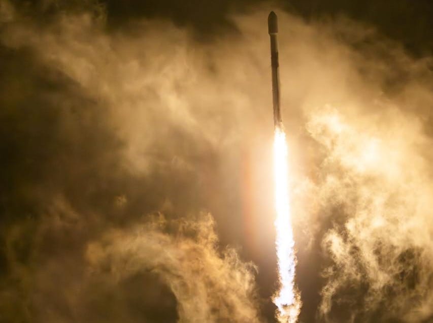
The spacecraft lifted off on a SpaceX Falcon 9 rocket from Vandenberg Space Force Base, California, at 9:21 p.m. PST on 16 November, with first contact established 90 minutes later. NASA confirmed that all systems are operating normally.
“Understanding tidal patterns down to the inch is critical in protecting how we use our oceans every day on Earth,” said Nicky Fox, associate administrator for NASA’s Science Mission Directorate.
She said Sentinel-6B will continue the work of its predecessor, Sentinel-6 Michael Freilich, by delivering precise sea level measurements used by communities and businesses, and supporting safe astronaut reentries, including future Artemis missions.
The satellite will measure sea levels at local and global scales from low Earth orbit, providing essential data for U.S. flood predictions and the protection of coastal assets.
It succeeds Sentinel-6 Michael Freilich, launched in 2020, which became the reference satellite for global sea level data.
Sentinel-6B is a joint mission involving NASA, ESA, EUMETSAT and NOAA, and forms part of the European Union’s Copernicus programme.
“This achievement demonstrates what can be accomplished when international agencies and industries work together toward a shared goal,” said Simonetta Cheli, director of ESA’s Earth Observation Programmes.
Alongside sea level data, the satellite will record wind speeds, wave heights, atmospheric temperature and humidity.
These measurements help identify warming waters that fuel hurricanes and reveal how major currents interact with surrounding seas, information vital for commercial shipping.
“Sentinel-6B is a testament to the value of NASA’s partnership missions,” said Karen St. Germain, director of NASA’s Earth Science Division.
The satellite will ultimately replace Sentinel-6 Michael Freilich as the official reference spacecraft once cross-calibration is complete.
Dave Gallagher, director of NASA’s Jet Propulsion Laboratory, said Sentinel-6B’s advanced instruments will measure about 90% of Earth’s oceans to fractions of an inch, continuing a vital dataset that nations around the world rely on.